
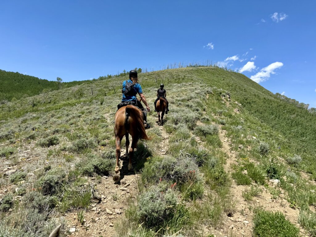
Atlas leaned back on his hindquarters. I gave him his head, and his forelegs dropped over the steep ledge. The rocks shifted on the slope, but held. His hind end caught up just in time to make a sharp turn, ducking around a switchback and under a branch.
Trees crowded the trail, forcing me to nudge Atlas’ ribs over in places as he navigated the descent. Some, freshly felled by a recent storm, had to be hopped over or clambered around.
In the gully below, a stream divided into fingers that hid beneath long grass and dense brush. The trail crossed its deepest point in a gash obscured by branches heavy with leaves. Atlas plowed through without hesitation, leaped the rocky bed, and resumed trotting up the other side.
Strawberry, I mused as we skirted ledges and danced along the rocky trail, wasn’t exactly what I’d expected…but so far, it was fun!
I didn’t realize when I picked this ride that it was an unconventional choice for Tevis prep. I chose it for practical reasons: driving distance, scheduling compatibility, lots of elevation change, and the opportunity to test our bodies’ responses to high altitude.
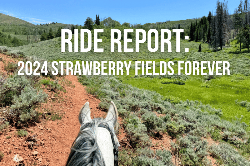
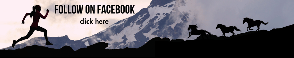
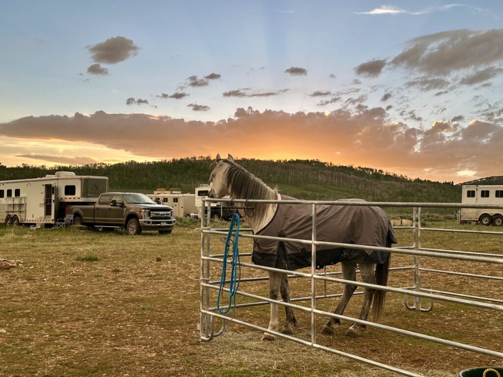
Besides, Strawberry Fields Forever – held in the Uinta mountains southeast of Salt Lake City, Utah – has been on my bucket list for a decade.
“It’s so beautiful,” people who have been there say. Also, “You have to step over a lot of logs.”
Friends, they weren’t kidding. You have to step over a LOT of logs.
Strawberry Fields Forever is an XP ride. If I understand correctly, XP is a club of riders who enjoy an old-school take on endurance: tough trails, casual atmosphere, and a heavy reliance on one’s own horsemanship over intensive veterinary supervision.
Managed by an endurance icon, “The Duck,” XP rides are not always AERC sanctioned, but they sometimes are (Strawberry 2024 was) and participating riders are a Venn diagram of XP and AERC members.
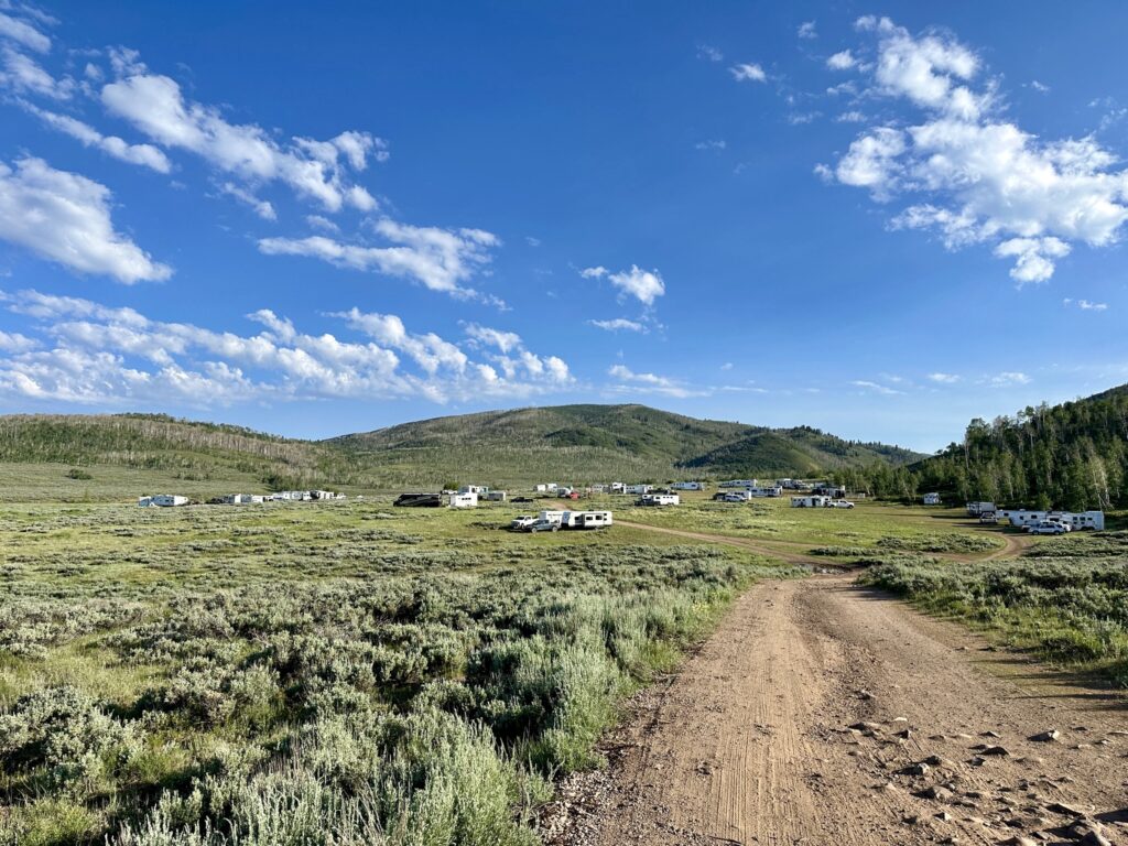
The rough nature of trail preparation, perhaps in combination with the take-it-as-it-comes XP culture, left pre-ride details thin on the ground. As a first-timer, I took to social media to gather some intel when I hadn’t heard from management by the day before departure. There, I learned that GPS would be critical.
Several kind folks messaged me with helpful tips. “I would definitely do this ride again,” one friend wrote, “…with GPS.”
The tracks arrived by email that afternoon. Whew! I downloaded them to my phone and, knowing I wouldn’t have connectivity in camp, added them to four different GPS apps. Just in case.
I haven’t used GPS a lot, but I did try the Garmin Earthmate app at last year’s City of Rocks and Ride With GPS on the Mary & Anna Memorial 100. I’ve found it fairly simple, but not 100% reliable, especially when I’m still on the learning curve for a particular app.
Word to the wise: Learn to use GPS. Experiment with several apps. Practice, practice, practice. Trust me, it’ll save you a lot of stress when you inevitably encounter a ride where GPS is more of a necessity than a luxury.
You’ve heard the expression do as I say, not as I do, right?
As it was, I found myself wandering around the edge of ridecamp the evening before Strawberry, trying to figure out which app would be most appropriate for the occasion. My friend Jen – who is on my Tevis crew and would be riding the LD the next day – and I settled on the Gaia app. The free version appeared to be working offline, and it pointed us in the right direction, albiet without the handy voice feature that makes Ride With GPS particularly helpful when you’re busy managing a hot horse.
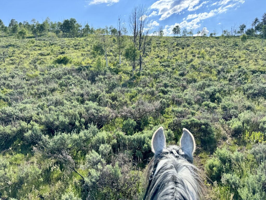
That voice feature would have been handy on ride day. Atlas took off like a rocket. He struck up the kind of trot that there’s no point trying to post. We flew along, with me standing in the stirrups, up a hill and into the woods. The dirt trail, mostly singletrack with some wider sections, was studded with rocks. Atlas stepped nimbly between them as a fresh, fit horse can do, and we picked our route together.
In one of the wide spots, we passed another rider. “You’re dragging a red line,” he called after us.
Uh-oh.
I glanced down.
Ack!
The 14-foot nylon flat line that I’d attached to Atlas’ halter for tailing practice had come loose. It had stayed put just fine on conditioning rides, but the extra speed and motion of race day seemed to have unspun the line from its coil at Atlas’ left shoulder.
Now what?
We were blazing along a narrow, rocky trail with sharp drop-offs in places, overtaking other horses and keeping an eye out for ribbons because there was no way in hell I could look at my phone. Now, I had a loose line to juggle as well!
I gathered it up in my hands, along with my very-busy reins, and tried to figure out what to do. There was no way we were stopping. I knew from the Sheep Incident that if I dismounted while Atlas was in this state, I would see many miles – and one very frustrated horse – before I could get back on.
I tried readjusting the line, pulling it back into proper loops, but it was impossible. For a while, I simply held the extra rope as we zoomed along. At least Atlas wasn’t tripping over it. But this wasn’t sustainable. I suspected the trail would get more technical soon. I would need my hands.
Time to push the reset button.
I reached down and unclipped the saddle bag strap that was holding the tailing line. Atlas charged on. The saddle bag bounced. The trail streamed beneath. I dodged branches, guided Atlas through a narrow, crumbling gap, recoiled the rope.
It took many tries to get the line re-clipped, but finally I managed it. Huzzah!
I turned my attention back to the trail just in time to reach the first stretch of downed trees. One after another, they littered the trail. Some lay on the ground, and others hovered more than two feet high. Atlas’ ears went up. Let’s go!
“Yes,” I whispered with my body, “let’s go.”
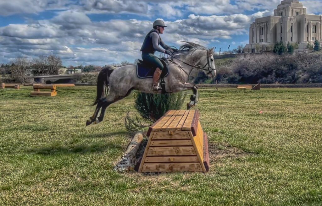
I aimed him at those logs with complete faith. Atlas has done a fair amount of cross country training at a stable nearby, so I knew he could handle much bigger jumps than these. Sure enough, he tucked his pretty knees and popped over every obstacle in sheer delight.
If the whole trail had been like that, we’d have finished in record time. But…it wasn’t. The downed trees continued to be a feature – despite amazing volunteers cutting literally hundreds of them out of our way – but were soon accompanied by steep, technical terrain.
There were switchbacks, marshes, crumbling hillsides, and trees scattered like giant Pick-Up Sticks. There were knee-high, criss-crossed logs to step over while easing down steep hills with rocks below and scraping branches above. There were hidden obstacles that would have scared the crap out of me if I’d known they were coming – but in my blissful ignorance, I found them entirely manageable.
Atlas was a champ! He never balked, never panicked, never failed to think his way through the sticky spots. Both alone and in a line of horses, he maintained the best physical and mental balance I could have asked for from such a young, energetic horse.
Most of the time, we had the trail to ourselves. This is my favorite way to ride. It gave us plenty of opportunity to bond over challenges shared only with each other, but it did have its drawbacks.
For example: getting lost.
The trail was marked with pink ribbons. In most places, there were enough ribbons to find one’s way, if not enough to always be confident. However, there were some long stretches through brush or meadows with no ribbons and no discernible trail (courtesy of cows, storms, and deep snow that cancelled last year’s ride and let the trails get overgrown). At times, I rode for extended periods with my phone in my hand, watching our little arrow weave its way along the green line until, at last, we found a ribbon.
But about those ribbons…they were all pink. All of them, for all the loops and all the days. This meant that seeing a pink ribbon didn’t necessarily mean we were on the correct trail.
Toward the end of the first loop, shortly after checking my GPS and slipping my phone into my pocket, I failed to notice that one set of pink ribbons curved off to the right while the other continued straight. I rode a good half-mile before checking my GPS again.
Was our arrow a little off the line? But generally in the right direction? Ish?
Oh look! Ribbon!
We trotted on, following a line of pink ribbons, with our GPS arrow pointed in generally the right direction…until the ribbons went left and Gaia pointed right. Dang it! These had to be the wrong pink ribbons!
Atlas and I backtracked until we found the right pink ribbons, falling in behind a couple riders who had been out of sight behind us for over an hour. Dang it. But at least Gaia was happy now!
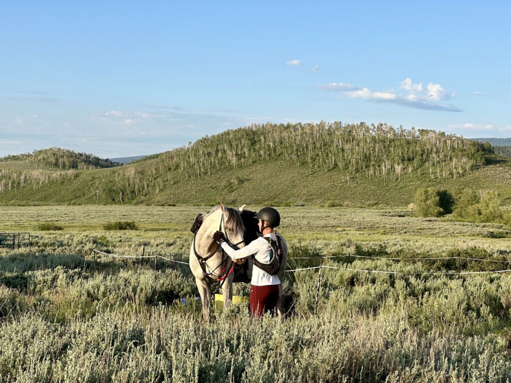
We trotted along over rolling singletrack, finally dropping into camp for a quick vet check and hour hold. For all that the first loop had been long and slow, with all those technical sections outweighing the speedy start, both Atlas and I felt strong and fit to continue.
I did notice that his Equipedic pad had slipped so the front edge was about an inch behind the front of my Bob Marshall. It couldn’t go any further, thanks to Velcro straps around the billets, but still…as I reset the saddle, I knew we’d have to find a solution to this issue before Tevis.
As it turned out, a solution would have been handy on the second loop. If I’d thought Loop 1 was technical, Loop 2 was rubbing its hands and cackling, “You ain’t seen nuthin yet!”
It was early afternoon and sweat trickled down my back as Atlas and I sloshed across a deep creek and up a winding singletrack through the woods. After a couple miles, the trail spit us out into a high meadow. I couldn’t find any more of the ribbons that had gotten us through the trees, but Gaia pointed me over a wide ridge and down into more woods.
Dense woods.
Is there a trail here?
I studied my phone, then the maze of evergreens.
Maybe over there, a narrow track beneath that bough… They did say sections of trail were hard to see…
Atlas and I followed the little line on my phone, down through drifts of pine needles and over fallen logs with broken branches spiking their spines. “Careful, buddy,” I urged. One twisted fetlock or slice along his cannon and our Tevis dream was done!
The woods grew thicker and the fallen debris more dense. I dismounted to lead Atlas under a dead branch whose needles showered my saddle. Gaia was taking us down a ghost of a trail, then another…
My gut feeling warred with the technology before my eyes:
Much of the trail has been rugged, said one side of my brain. This isn’t that much worse. And look at the GPS! We must be really close to the trail.
Eh, said the other side. I dunno. The terrain is getting downright dangerous. This can’t be right.
But we’re on the line, headed in the right direction!
But it’s all trees and snags. There’s no way through. I’m telling you, this isn’t right.
Finally, we turned back. I led Atlas up the steep hill, bushwhacking through the non-trail (definitely not a trail!) in the general direction of the last ribbon we’d seen. Several times, we hit impassible obstacles and I had to back Atlas downhill, around or over trees, to try another way.
It sounds awful, I know, but even in that hot and stickly place, with risk all around and time a’wasting, my heart sang.
Look at us working together! Trusting each other. Getting through the hairy shit as equal partners. This is not the ride we planned, but it is exactly what we needed.
We burst back into the meadow – relief! – and spotted a trio of horses trotting along a definite trail. How had we missed that?
I checked Gaia again. Yep, we were right on the line…but we had been down in the woods as well…
Ohhhhhhhh. *facepalm* I should have zoomed in more!
A closer view would have revealed that Atlas and I had been bumbling around in the right general direction, but several hundred yards off trail.
Did I mention that GPS isn’t my strong suit?
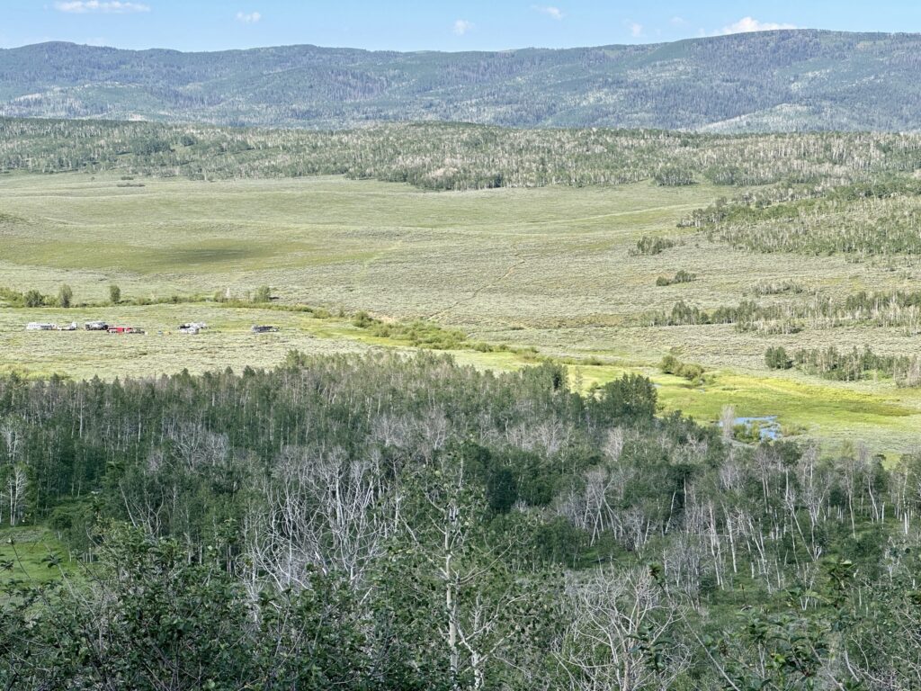
Slowed but not disheartened, Atlas and I powered up yet another steep, rocky singletrack to the Great Wall. I dismounted to lead him along the steep side slope that fell away from a long, granite formation characteristic of the Uintas.
It was so impressively difficult to stay on my own two feet that I just had to get a photo…which, sadly, doesn’t capture the half of it. This was sketchy stuff – so much so that I later learned some riders take a safer (albeit less scenic) route on the other side of the wall.
Then, down the other side! Several other riders shared this section of trail with us, and I was interested to note that about half (including me) chose to lead our horses while other stayed aboard. I don’t think either was an inappropriate decision, but personally, I was grateful for the the fitness to make that descent easier and safer for both myself and my horse.
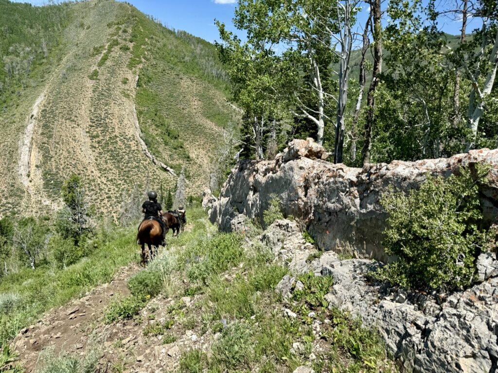
At the bottom, I mounted back up for yet another climb to the highest point of the ride – about 11,000 feet. This, along with a lot of other trail in the 9,000-foot range, was something I wanted to experience. I’ve run into physical issues before while backpacking at lower elevation than this, so I wanted to know if I was likely to struggle at the high point of Tevis (8,750 feet). More importantly, how would Atlas feel up in the thinner air?
As it turned out, we both felt just fine. I could tell that I had less stamina for running beside Atlas, but riding – even hard riding – wasn’t an issue. Up there on the naked summit, with spectacular views falling away on all sides, we felt literally and figuratively on top of the world.
Ahead lay one, final descent – the steepest and most treacherous of all. Again, I dismounted, so Atlas was walking behind me when we hit an obstacle: a newly-fallen tree tipped at a 45-degree angle across the trail. Most of it was too high to jump, but too low to duck under. Another tree’s thick, live branch blocked the low point of the fallen tree. There was no way around, either above or below us on the side slope.
Ummm…okay! We can do this.
I asked Atlas to wait while I climbed ahead over the fallen tree. Then, I backed as far up the crumbling side slope as possible – barely enough to get myself out of the way – and pulled the live limb into my chest to clear Atlas’ way.
“C’mon, buddy!”
He understood. As soon as I was ready for him, Atlas leaped over the fallen tree, landing inches from my feet, and took a couple steps forward so I could release the live limb like a gate snapping shut behind us.
“Good boy!”
After that, the rest of the ride was gravy. We fought a bit about how fast we’d travel the final seven miles into camp. Atlas could easily have sped along, but I’d thought for a second that he was slightly off (horror!), so I made him walk for a while behind another horse.
This doubled as a training opportunity for Tevis, where we will certainly be held up at times behind lines of riders. I wanted to be sure Atlas wasn’t likely to blow a gasket in a sketchy spot. He had his moments during that stretch, but overall held it together pretty well.
The cherry on top was the belly-deep, solid-bottomed bog (dubbed the No-Bog Bog) that Atlas forged through without blinking an eye.
American River crossing, here we come!
Back in camp, completions in the bag, Jen and I pondered our options for the next day. Ride again? Stop while we’re ahead?
If I didn’t do another 50 at Strawberry, and then failed to complete Tevis, Atlas and I wouldn’t have enough miles together to qualify for the National Championship ride in August…but Tevis, not NC, was our highest priority.
Ultimately, we decided that the technical trails skewed the risk-benefit analysis in favor of not riding. I had plenty of horse left, but wasn’t willing to risk him getting hurt.
Strawberry is a challenging ride with a mixed reputation. If you’re considering it, here’s my take:
Do it. It’s beautiful. BUT:
- Make sure you’re on a good technical horse
- Be prepared for a long day with a relatively slow time
- Have the GPS tracks and know how to use them
- Be confident in your ability to assess your own horse’s wellbeing
This time, though, we lucked into the perfect choice. The more I learn about the Tevis trail, the more pleased I am to know that Atlas has good technical skills, both mentally and physically. I’m confident that he’ll take on whatever I ask: Cougar Rock, the river crossing, hot climbs, and scary descents.
Even better, I’m confident that Atlas and I believe in each other. When we had to trust, we did — and we proved ourselves worthy.
Strawberry, with all its challenges, made us a team.
You might also like
Your story about Strawberry Fields is very accurate! Well written!
Thanks so much! 🙂